

Major projects
The work of the Southeastern Grasslands Institute spans SGI’s focal region. Below are listed our main research projects and collaborators at this time. Please contact our Chief Conservation Officer Theo Witsell with any questions about SGI research projects.
“People have a misconception that we have a relatively complete understanding of southeastern grasslands. We don’t. They began to decline on the eastern edge of our region in the 1600s and this loss spread west with settlement. Today, our southeastern grasslands are among our rarest and most-threatened ecosystems. Many types have never even been named or described, which is also true of some species they support. There is also an urgent need for scientific information to inform the protection, restoration, management, and reconstruction of these imperiled ecosystems. SGI feels the urgency of this need and is working to be a leader in both grassland science and historical research.”
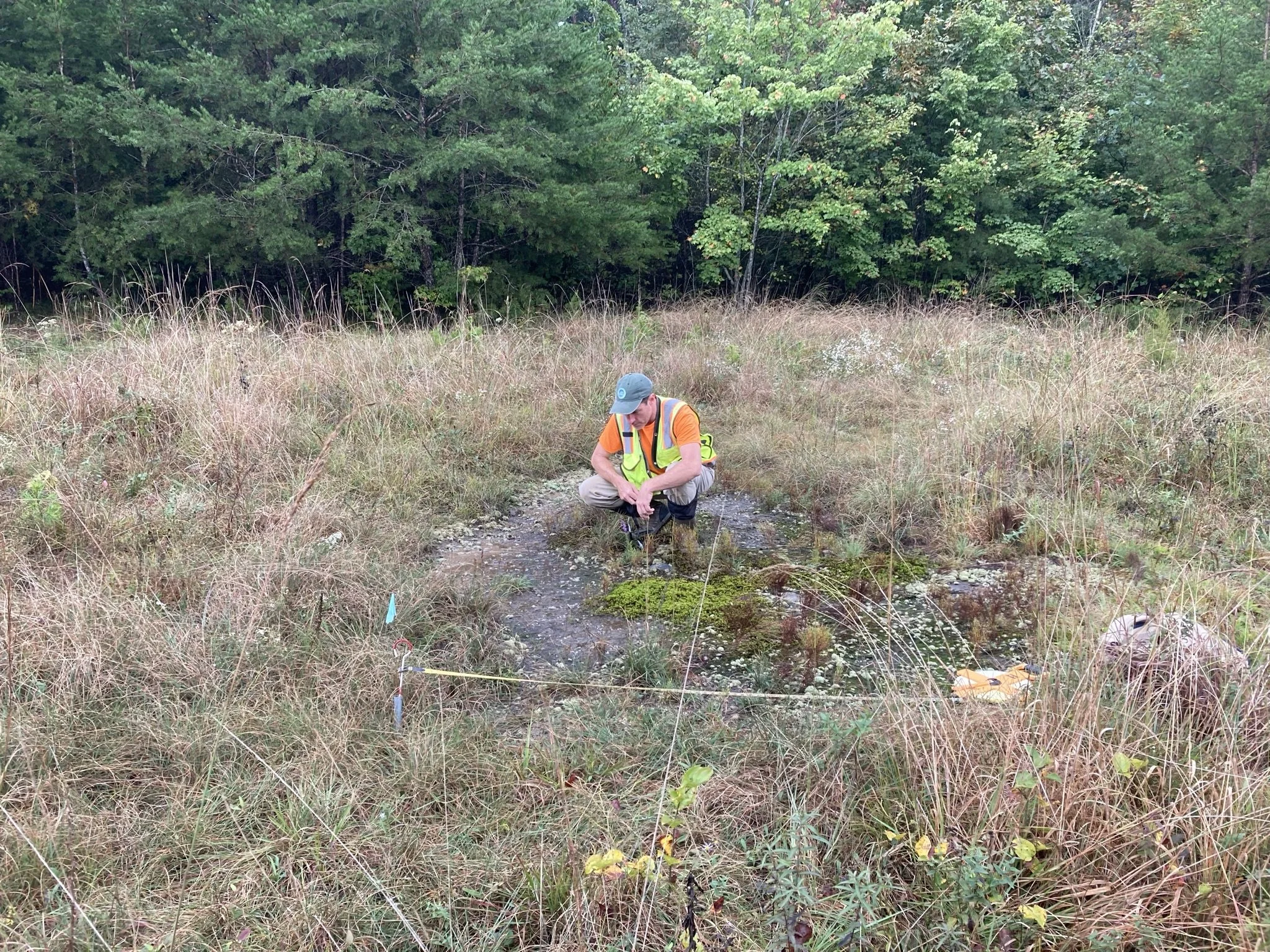
Appalachian Bog Restoration
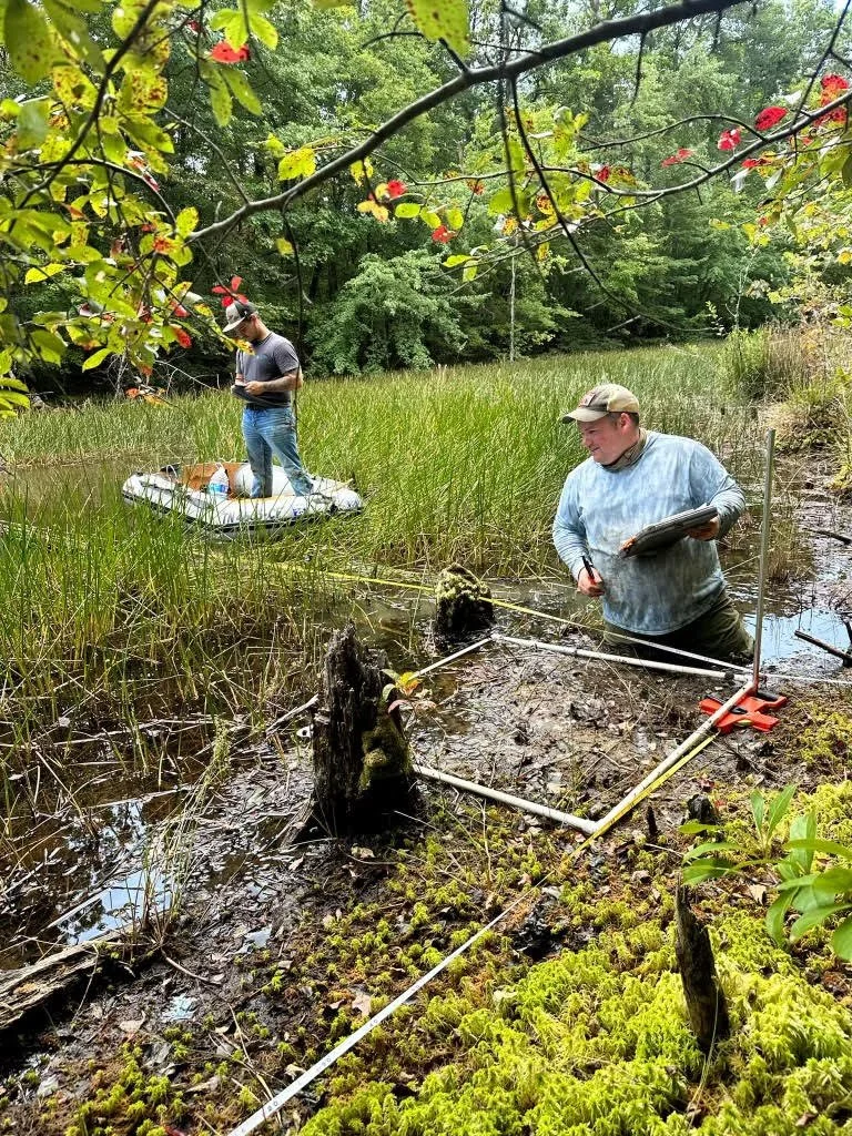
SGI Southern Appalachian coordinator Zach Irick leading vegetation monitoring in a bog in Marion County, Tennessee. The dominant plant around the boat is the rare Horsetail Spikerush (Eleocharis equisetoides), known to persist in Tennessee only at this site. PC: Quentin Miller.
SGI is leading the studies on the efficacy of techniques to restore mountain bogs—some of the rarest wetland ecosystems on the Cumberland Plateau— and a priority in Tennessee’s State Wildlife Action Plan. These efforts target the recovery of imperiled species and include establishing butterfly meadows and canebrakes, reintroducing essential native plants, and building long-term datasets to guide adaptive management and ensure lasting ecosystem resilience. The project’s goal is to revive the natural processes that once sustained these wetlands and to support native plants like Large Cranberry (Vaccinium macrocarpon) and Tawny Cottongrass (Eriophorum virginicum).
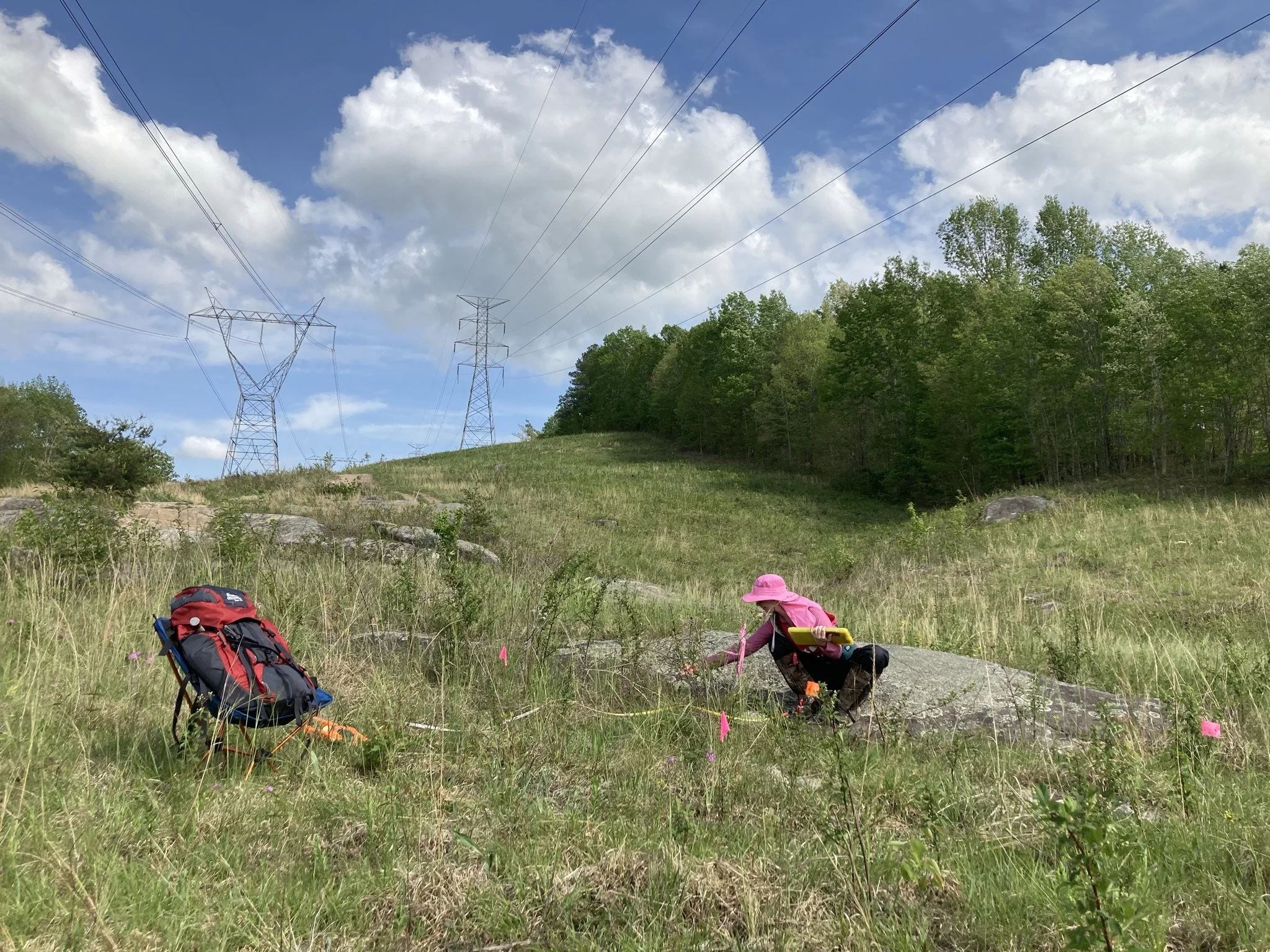
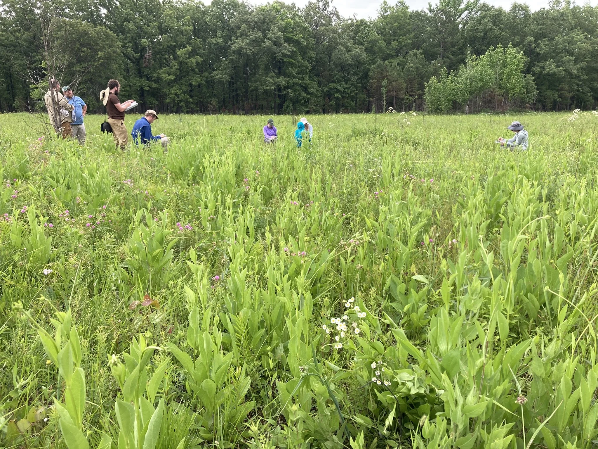
Carbon sequestration in southeastern grasslands
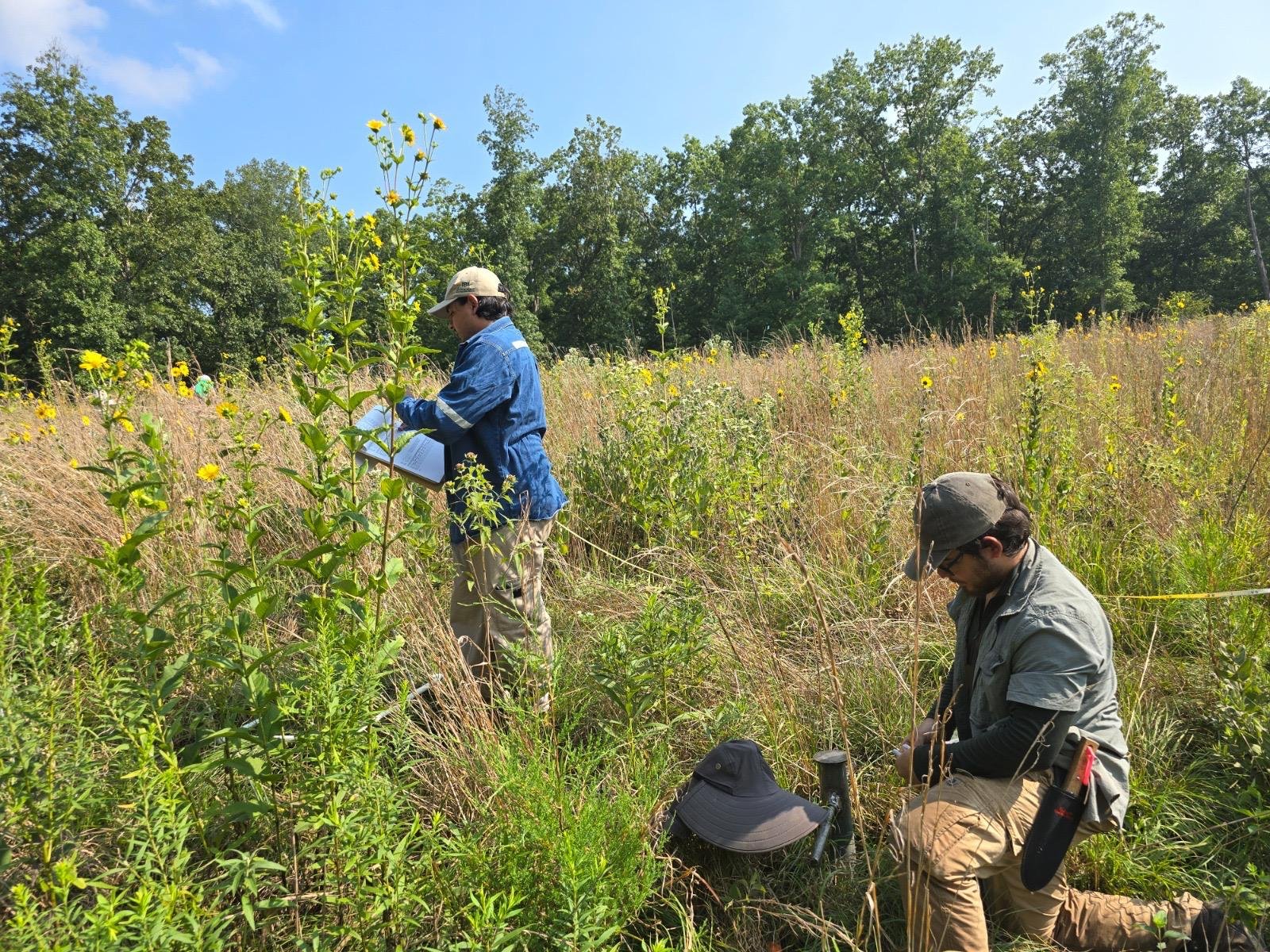
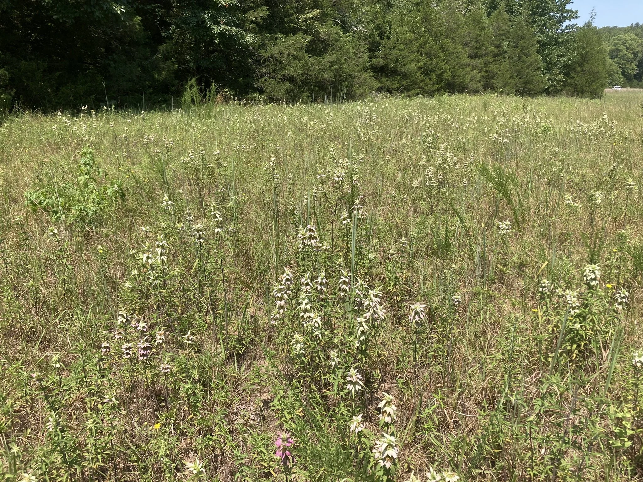
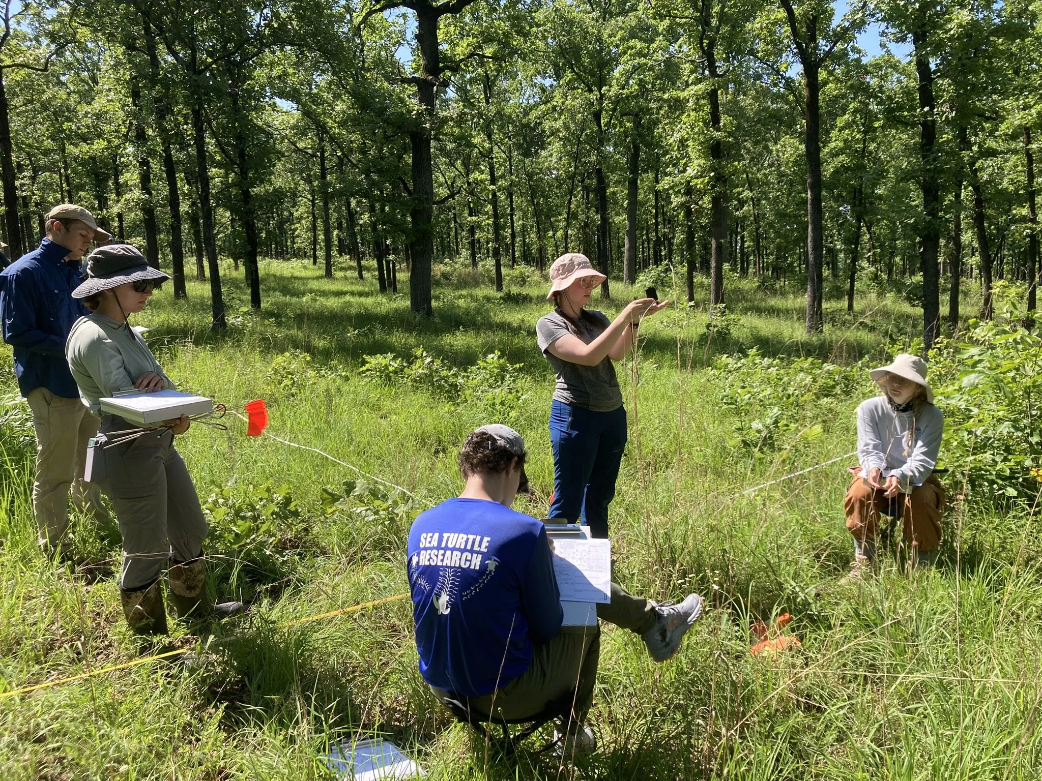
Pedro Velez and Fernando Mendoza sampling vegetation and soil at Best Hope Farm prairie (Dickson Co., TN). PC: Josue Chevez-Sahona.
SGI is collaborating with Dr. Heather Alexander & graduate researchers at the Auburn University Auburn Forest and Fire Ecology Lab to evaluate the ability of grassland ecosystems to sequester the greenhouse gas carbon dioxide in the soil. Researchers are especially interested in whether grasslands with a larger number of plant species are more effective than grasslands with only a few species in sequestering carbon, and whether certain plant species are more effective than others at moving atmospheric carbon into the soil for long-term storage. This project is funded by the Tennessee Department of Environment and Conservation.
Cumberland gap national historical park

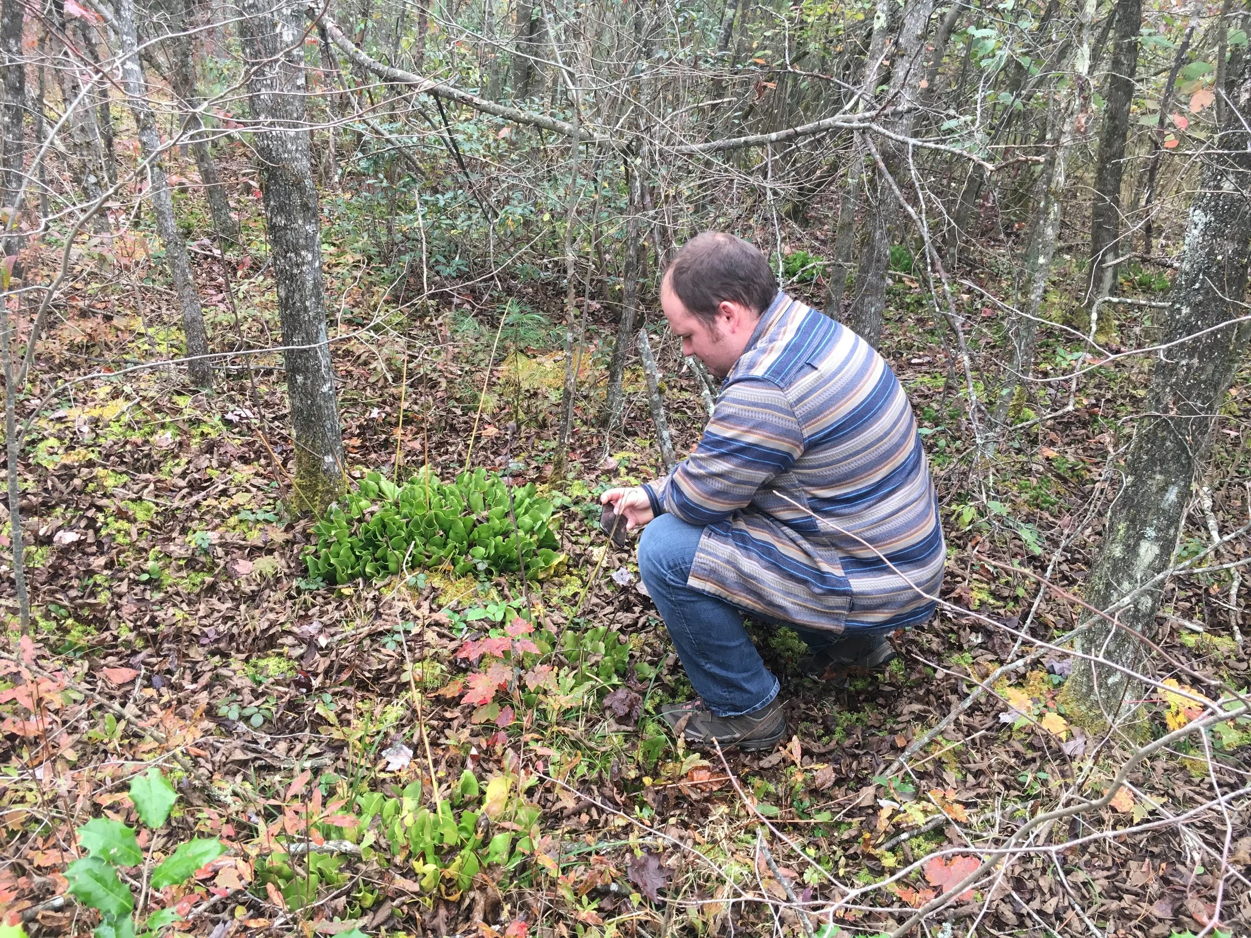
SGI's Southern Appalachian Grasslands Coordinator Zach Irick exploring a small bog at the base of a cliff deep in the backcountry of Cumberland Gap National Historical Park. PC: Alaina Krakowiak.
At Cumberland Gap National Historical Park, SGI is partnering with the National Park Service and the Office of Kentucky Nature Preserves to survey and protect rare plant species. This work led to the discovery of a population of the federally endangered White Fringeless Orchid (Platanthera integrilabia) and the first known Kentucky population of Mountain Quillwort (Isoetes valida) in the remote Martin’s Fork area. Through ongoing field research and collaboration, SGI is deepening scientific understanding of the park’s unique grassland, cliff, and bog ecosystems. Check out our blog on the project here. Final report available soon!
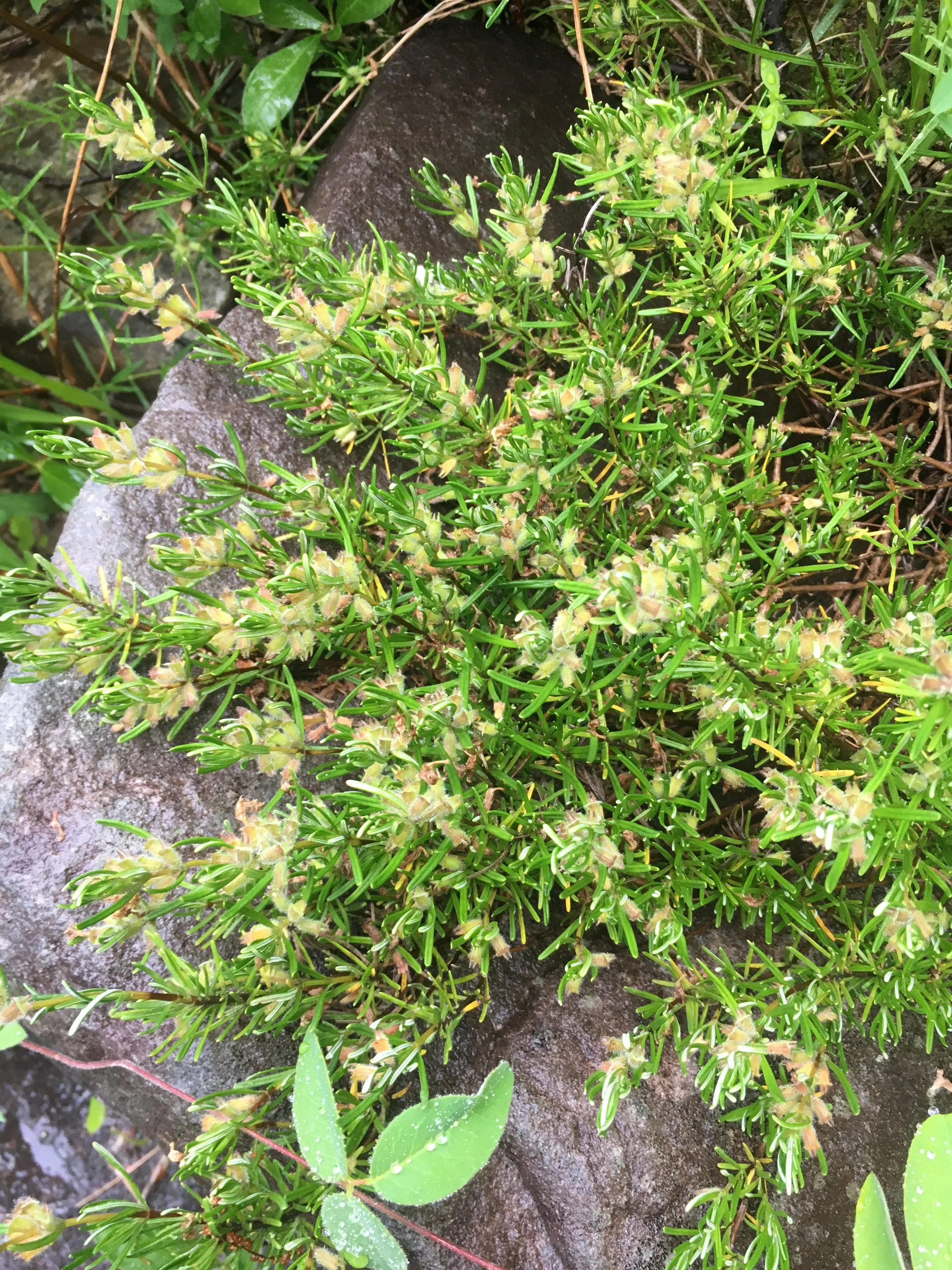
Cumberland plateau grasslands status assessment and conservation plan
Cumberland Rosemary (Conradina verticillata) growing in high-quality riverscour barrens along the Clear Fork River within the Big South Fork National River and Recreation Area in Tennessee. This species is listed as Threatened under the federal Endangered Species Act and is found only in riverscour habitat on the Cumberland Plateau of Kentucky and Tennessee. PC: Theo Witsell.
The Cumberland Plateau, a roughly 9.4 million acre ecoregion on the western part of the Southern Appalachians, is a diverse landscape that historically supported a mosaic of forests, open woodlands, savannas, and embedded grasslands such as glades, bogs, and riverscour. While large areas of forest remain today, the grasslands have declined dramatically from their historical extent and quality, and are a major conservation priority. With funding from the National Fish and Wildlife Foundation, we are compiling the first-ever status assessment and conservation plan for open ecosystems of the region and the species that depend on them. The final report for this effort should be released in early 2026.
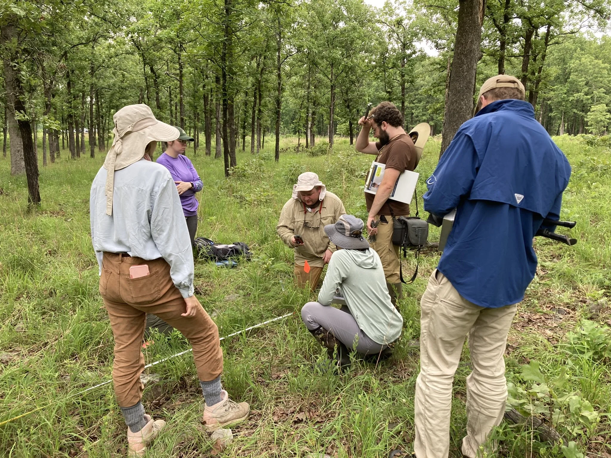
Grassland quality assessment
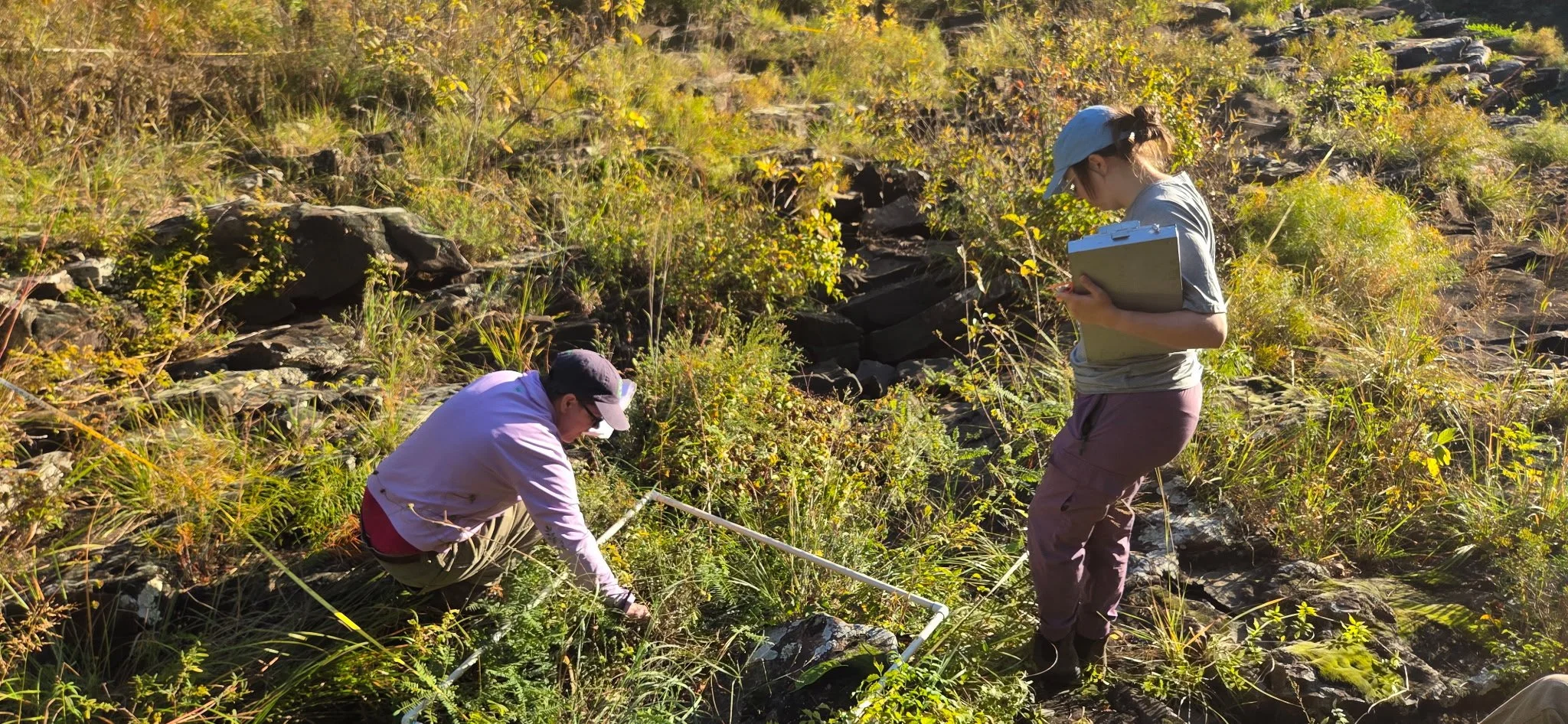
SGI’s Western Region Biologist Allison Wilson (right) and volunteer Virginia McDaniel (left) sampling an excellent-quality riverscour barrens on the Maumelle River in the eastern Ouachita Mountains. PC: Ben Thesing.
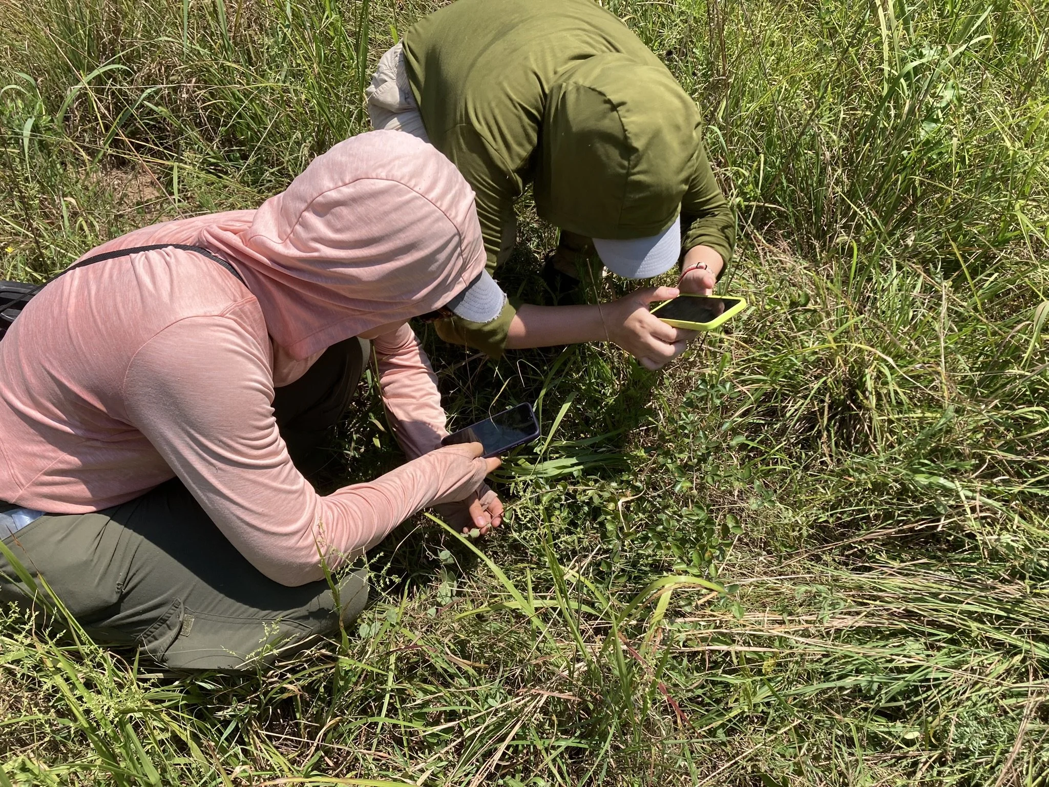
The SGI research team is developing new tools to both find grasslands and assess their quality. Based on the presence or absence of key indicator species, we are developing ways to identify if degraded or overgrown lands were natural grasslands historically. These tools will also help determine restoration potential of degraded grasslands which will inform restoration strategies.
Grasslandia
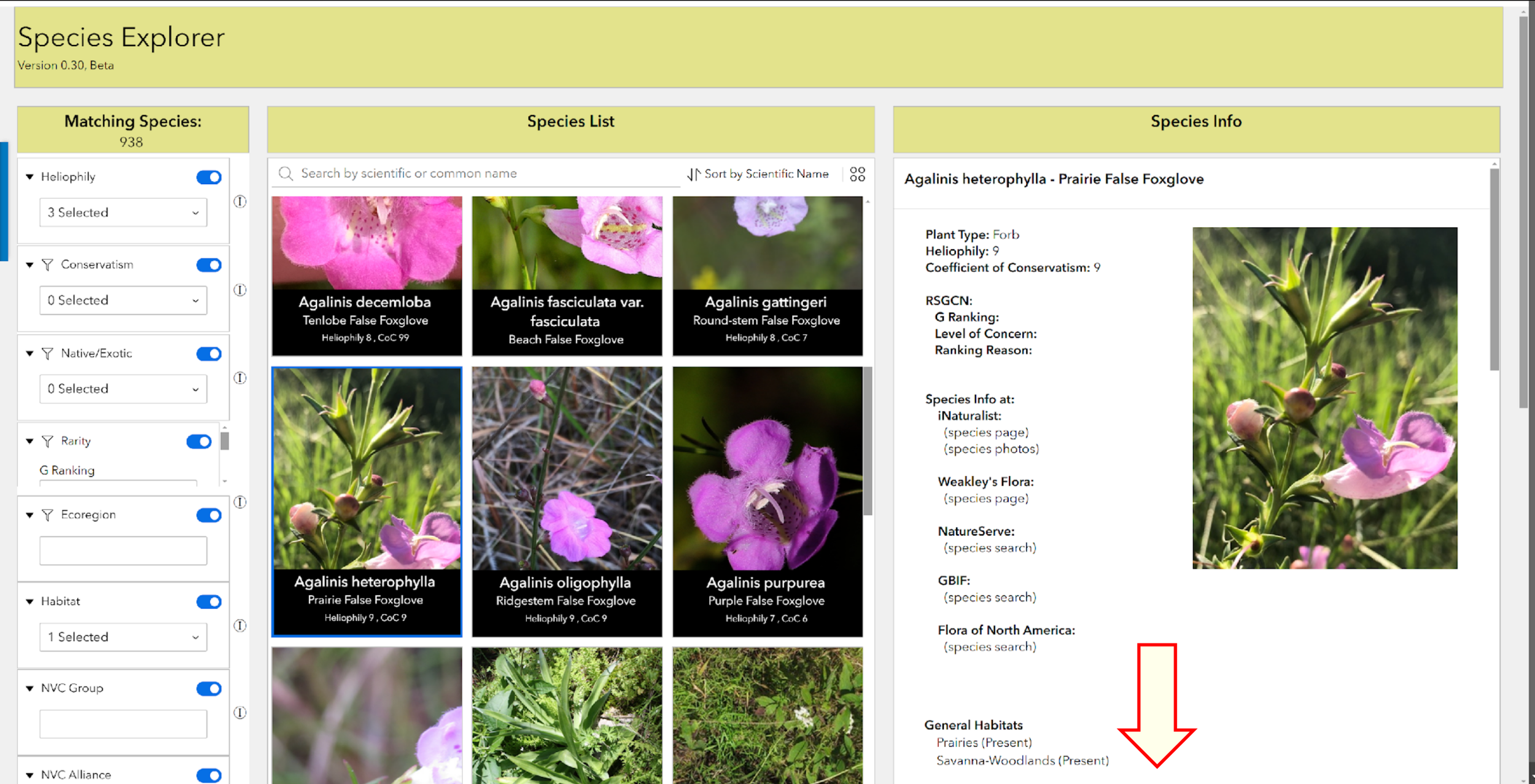
Screenshot from the Grasslandia portal.
SGI is developing a public online grasslands information portal and decision support tool called Grasslandia. This spatial, GIS-based platform will allow users to access a wide variety of historical and scientific information on grasslands through a map-based interface. From maps of where grasslands were found historically, to images and descriptions of remnant grasslands, to species lists and best practices for grassland restoration and management, Grasslandia will be a one-stop shop for all things grassland. Funded by the US Department of Agriculture, SGI research staff are working in partnership with ESRI and the Natural Resources Conservation Service (NRCS) on this ambitious grassland information clearing house. Stay tuned for updates on Grasslandia! Click here to learn more about mapping historical grasslands. Check out our blog Six Good Clues that a Southeastern Grassland was Here by Theo Witsell.
improved grassland classification & Mapping for the southeast
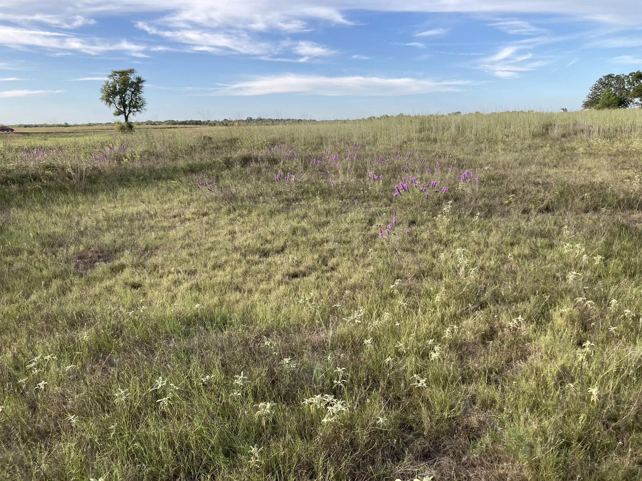
This globally rare Arkansas Valley Prairie Seep is an example of an undescribed natural community known from just a few sites in the world. It is totally distinct from surrounding prairies and supports many rare species including several typically found in Coastal Plain pine savannas far to the south. PC: Jennifer Akin.
SGI staff and partners are working on classifying and describing all the different types of grasslands in our focal region. To date, 118 unique grassland natural communities have been recognized in our region, but many others remain undescribed. Access our Guide to Grasslands of the Midsouth here. For a general overview of main categories of grasslands, please visit our page What are Southeastern Grasslands?
national park service partnership
SGI has entered into a partnership with the National Park Service that spans 40 National Parks. A majority of SGI staff are involved with this project. The goals of the project are to restore grassland habitats and ecosystems, and to monitor important species of plants and invertebrates in grasslands in our national parks, with major work scheduled to be published in peer reviewed journals.
Outside of our current project, SGI has worked in 60 of the U.S. National Park Service units within the eastern United States.
new Species Descriptions
Newly described species Stiletto Beaksedge, Rhynchospora stiletto. PC: Claire Ciafré.
From insects to plants, SGI’s staff and affiliates are aware of many undescribed, or “new”, grassland species that are unknown to the scientific community. Formally describing these species can take years of field and museum work as well as DNA analysis. Research on multiple species are currently underway by SGI staff and partners. Click here to see SGI’s publications.
pitcher-plants (Genus sarracenia)
SGI’s southern Appalachian coordinator Zach Irick monitoring a population of the federally listed endangered Green Pitcher-plant (Sarracenia oreophila) at Dulaney Bog in North Carolina. PC: Theo Witsell.
SGI's Southern Appalachian Ecologist Zach Irick and collaborator Dr. Ashley Morris (Furman University) conducted an ecological and genetic assessment of the federally Endangered Green Pitcher-plant (Sarracenia oreophila) at Little River Canyon. They monitored and sampled all known sites in the preserve and found that, genetically speaking, there are two populations, spread across nine distinct sites. They also found that because the species is clonal, distinct clumps of plants in a site may not be genetically distinct individuals. The ecological component of their study found that there is a critical need for consistent management of sites, requiring burning every two years, to keep populations healthy and reproducing.
prairie reconstruction Research
Google Prairie
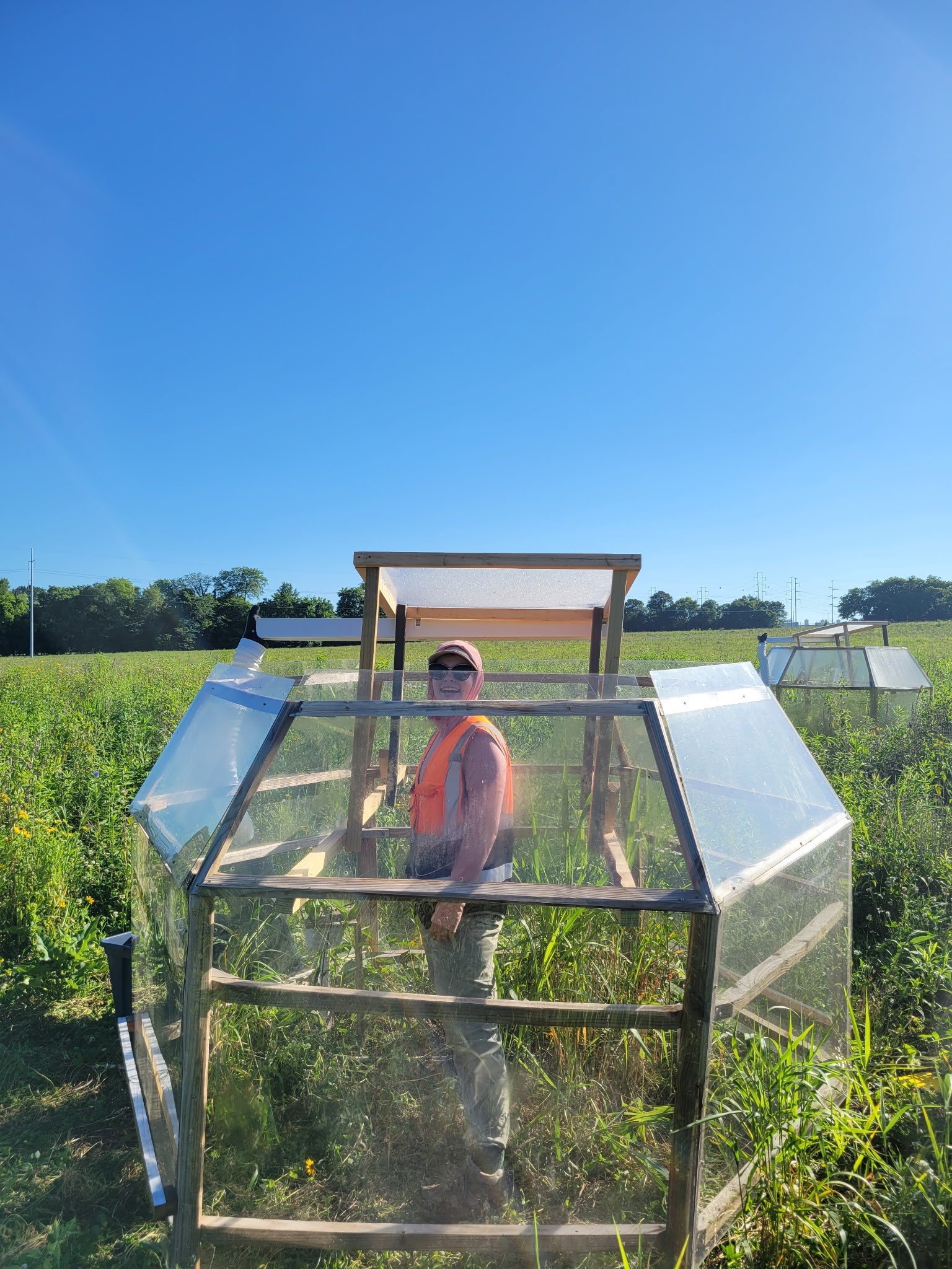
Climate domes used in field experiments in SGI managed Google Prairie in Clarksville, TN. PC: Laura Hunt.
SGI’s reconstructed prairie at Google’s data center in Clarksville, TN continues to serve as a site for various research studies. In addition to being a laboratory for SGI’s restoration staff to study various restoration and management techniques, it has served as a site for experiments testing how pollinator presence or absence affects native and invasive forbs, and to study various effects of climate change on prairie ecosystems. Additionally, research on mammal communities at the site is being conducted by SGI and APSU partners.
National Fish and Wildlife Foundation Anchor Sites

Photo of the SGI team conducting a prescribed burn at a grassland anchor site in Dickson Co, TN. PC: Eleanor Lopez.
Surveying for rare and sensitive species on prairie reconstruction sites and monitoring their populations is a core part of our National Fish and Wildlife Foundation funded projects to stabilize, restore, and reconstruct 2,500 acres of the forgotten grasslands of central TN.
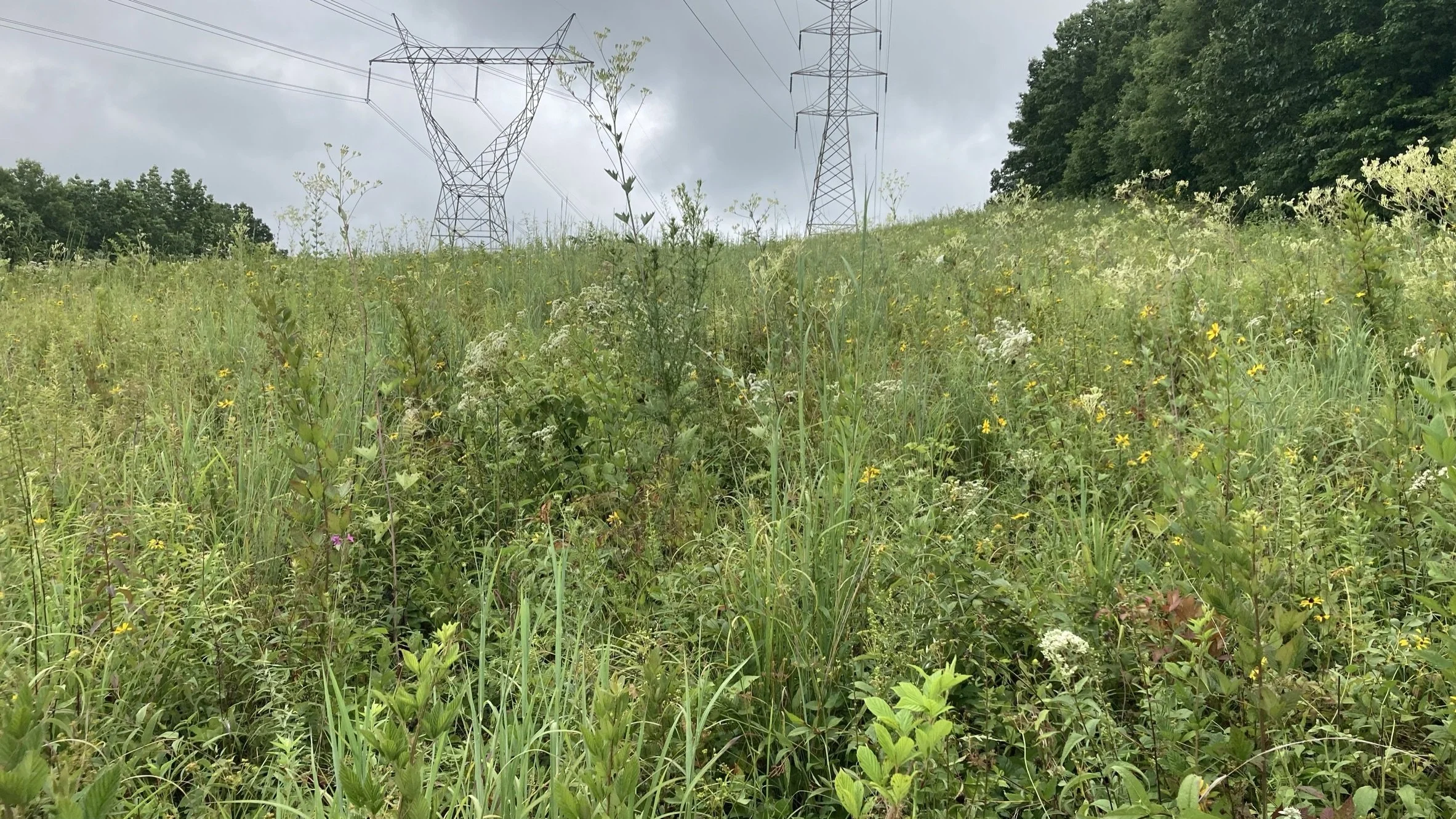
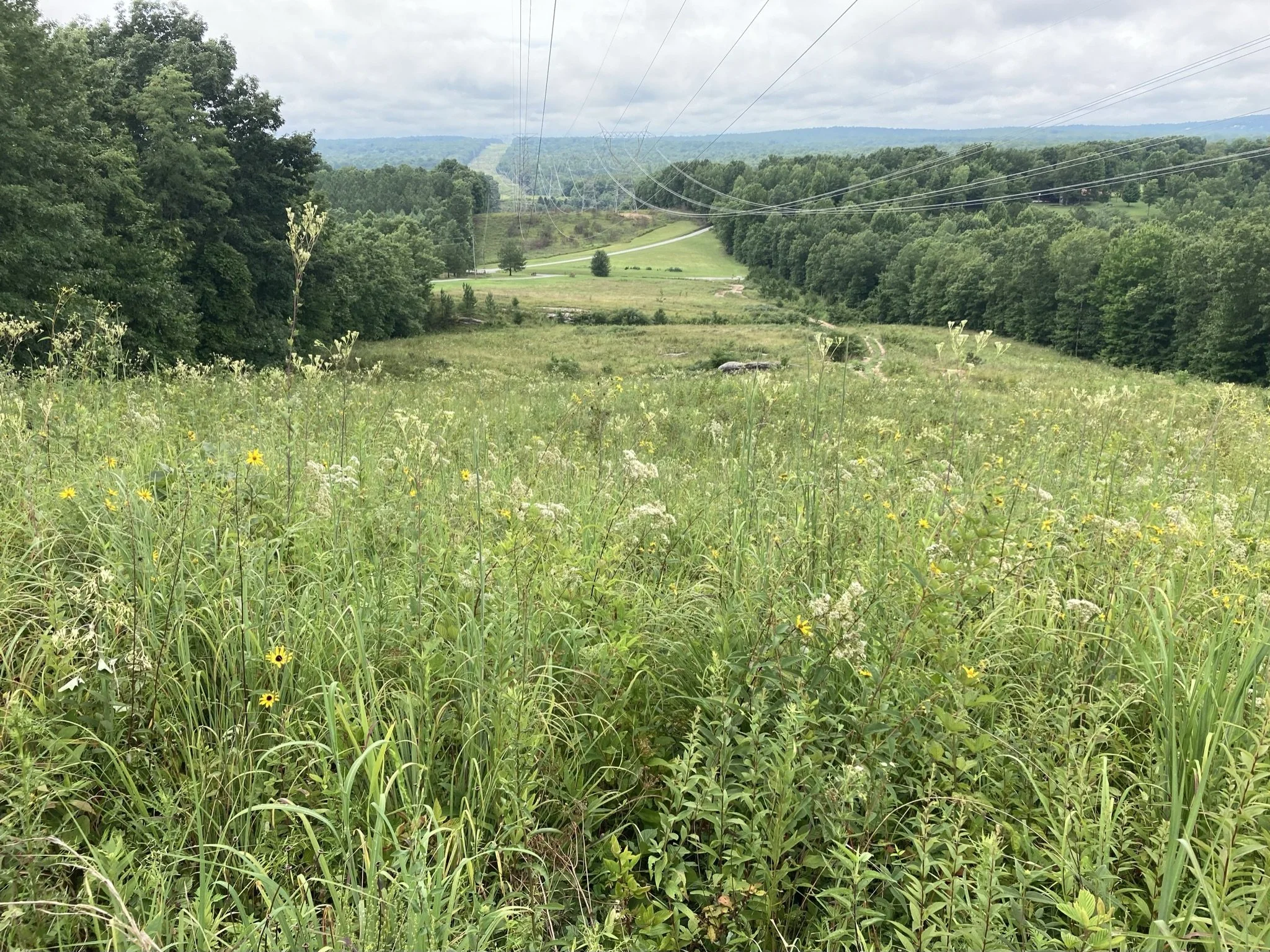
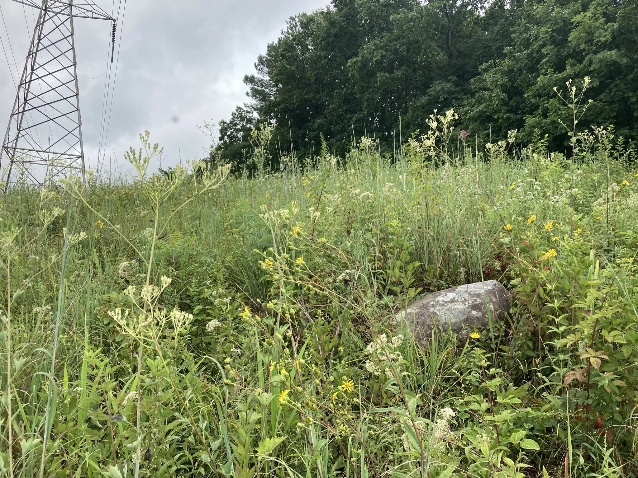
Right-of-way grasslands
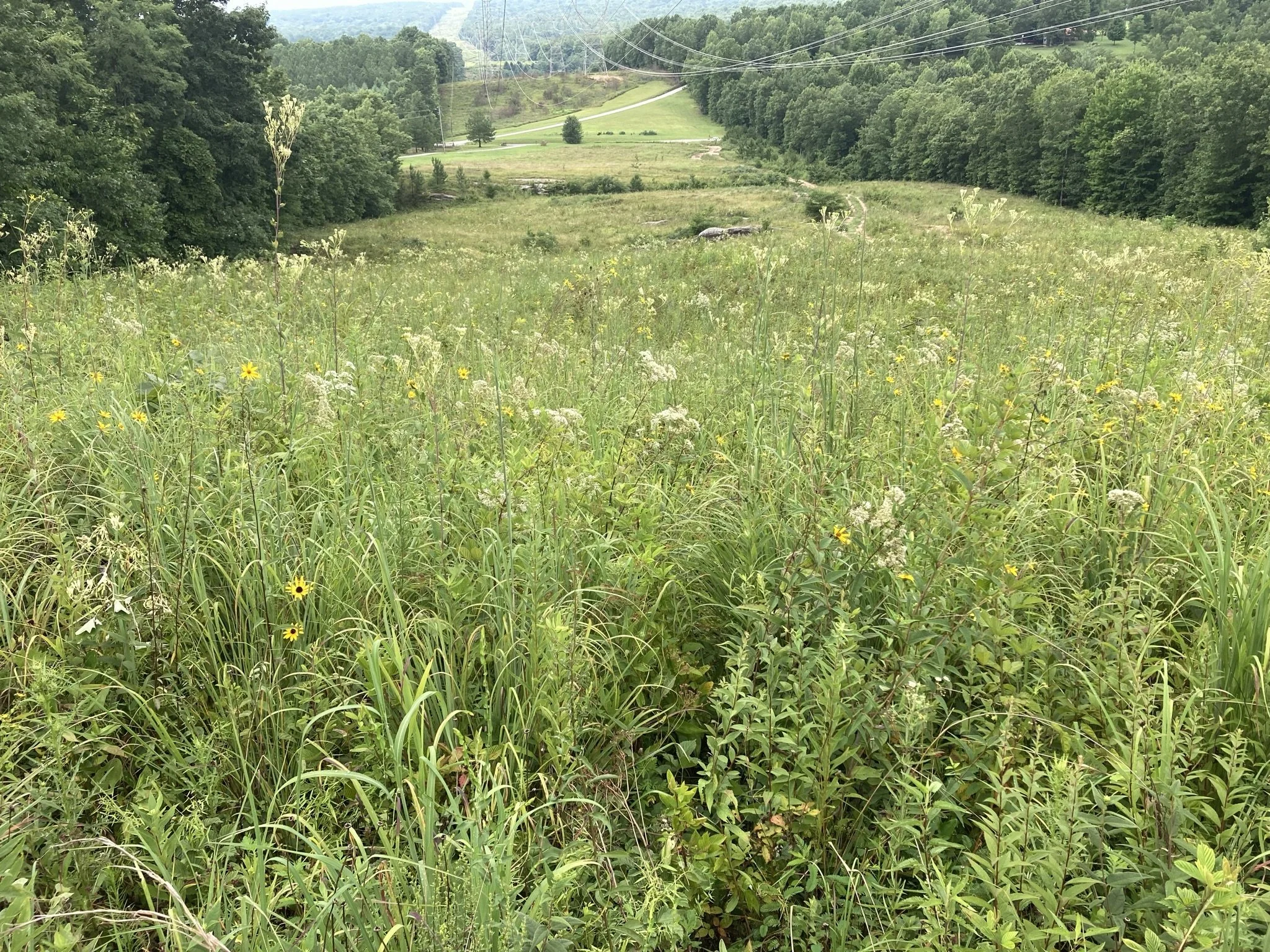
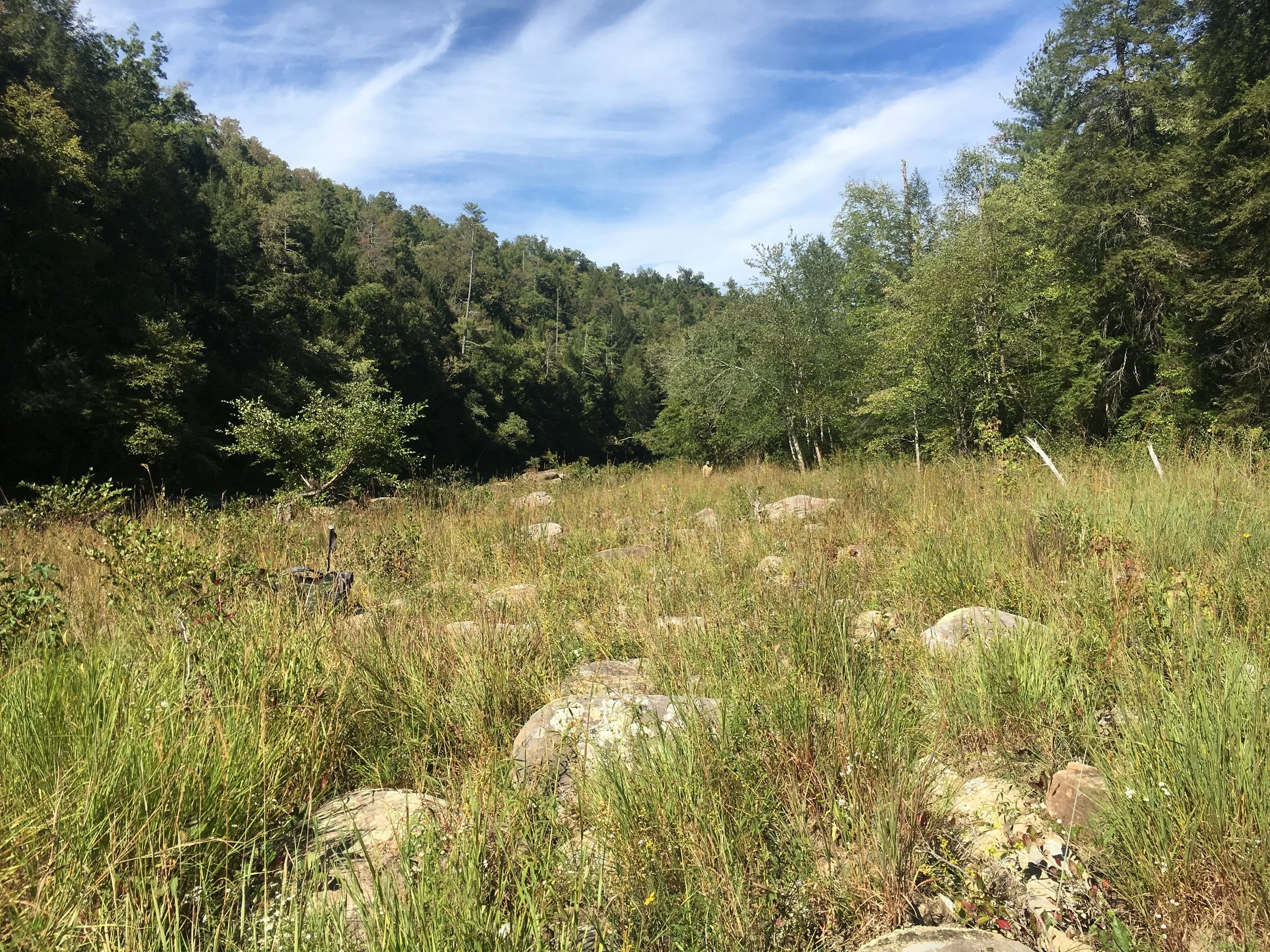
High-quality grassland remnant in a powerline corridor at Cumberland Trail State Park in Cumberland County, TN. This grassland flora represents the natural ground cover of open savannas found historically in this region of the Cumberland Plateau. Today, these natural communities are rare due to impacts from past land use and encroachment by closed forest in the absence of fire and native herbivores. PC: Theo Witsell.
Rights-of-way along roadsides and utility corridors like powerlines and gas lines are critical reservoirs of southeastern grassland biodiversity. In many regions, the prairies have all been plowed and the savannas have grown up into unnaturally dense forests, choking out sun-loving species.
Rights-of-way, some now nearly a century old, have served as critical refugia for grassland species and SGI is always on the hunt for these grassland remnants to search for rare species, collect seed, or look for grassland animals. In partnership with the Tennessee Valley Authority, the Electric Power Research Institute, and the Mississippi Entomological Museum (Mississippi State), SGI completed four years of field work and data collection that will result in a series of publications. The publications will center on data on the plants and pollinator biodiversity of large TVA rights-of-way under powerlines compared to the biodiversity under adjacent closed canopy forested areas. Many of the TVA rights-of-way contain rare grassland species throughout the southeastern U.S. To learn more about SGI’s work in Rights-of-Ways, check out our blog series on Rights-of-Way grasslands by Theo Witsell.
Riverscour Research
Beautiful Barbara’s-buttons (Marshallia pulchra), a globally-rare plant listed as Endangered in both Kentucky and Tennessee, growing in high-quality riverscour barrens along the Clear Fork River within the Big South Fork National River and Recreation Area in Tennessee. PC: Theo Witsell.
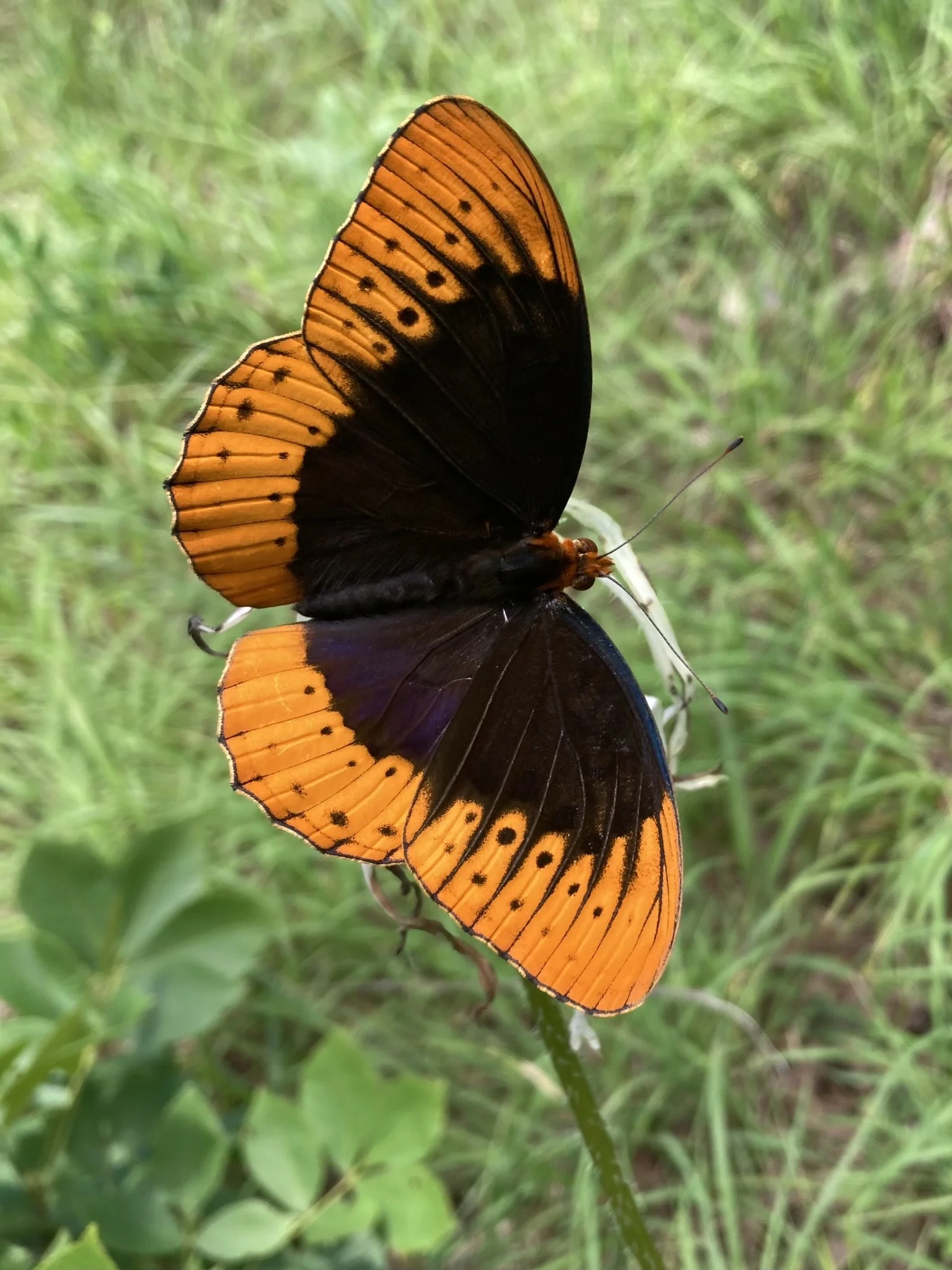
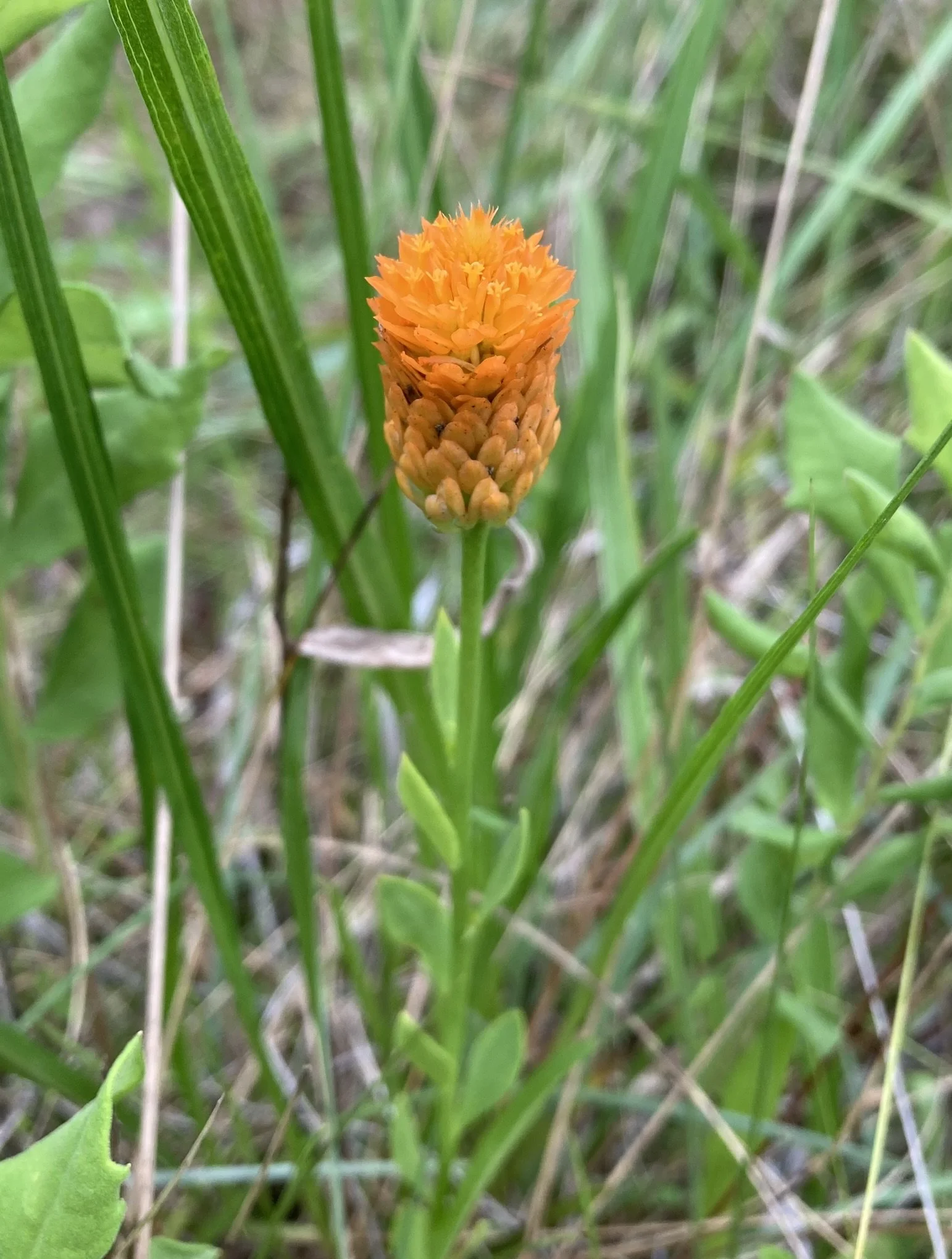
Through millennia, many separate entrenched river systems have developed their own unique miniature riverside grasslands called riverscour. These communities have high biodiversity, with over 90 plant species in a single 10 x 10 meter plot! This richness rivals that of longleaf pine savannas, and for some river systems we have found more than 500 species of plants in nine river miles, restricted to the flood-scoured grassland zone. At least a dozen endemic plants are restricted to these intense, flood-maintained grasslands, and occur here and nowhere else on Earth. These grasslands support hundreds of plant and animal species, including timber rattlesnakes, butterflies, bees, and countless other species. Recent research shows that there are at least six undescribed plant species in these rich ecosystems that are completely new to science.
Despite their importance, there is limited representation of riverscour ecosystems in the scientific literature. Much of what’s out there is focused on botanical studies and less on these systems as a whole. To learn more about our riverscour work on the Cumberland Plateau, click here.
Specimen-based research

Herbarium specimen of the endangered grassland-obligate plant American Chaffseed (Schwalbea americana) collected from the Cumberland Plateau Ecoregion by Ferdinand Rugel in 1842. It has not been documented in that ecoregion since, but must have occurred in fire-maintained grasslands. Photo courtesy of the New York Botanical Garden Herbarium.
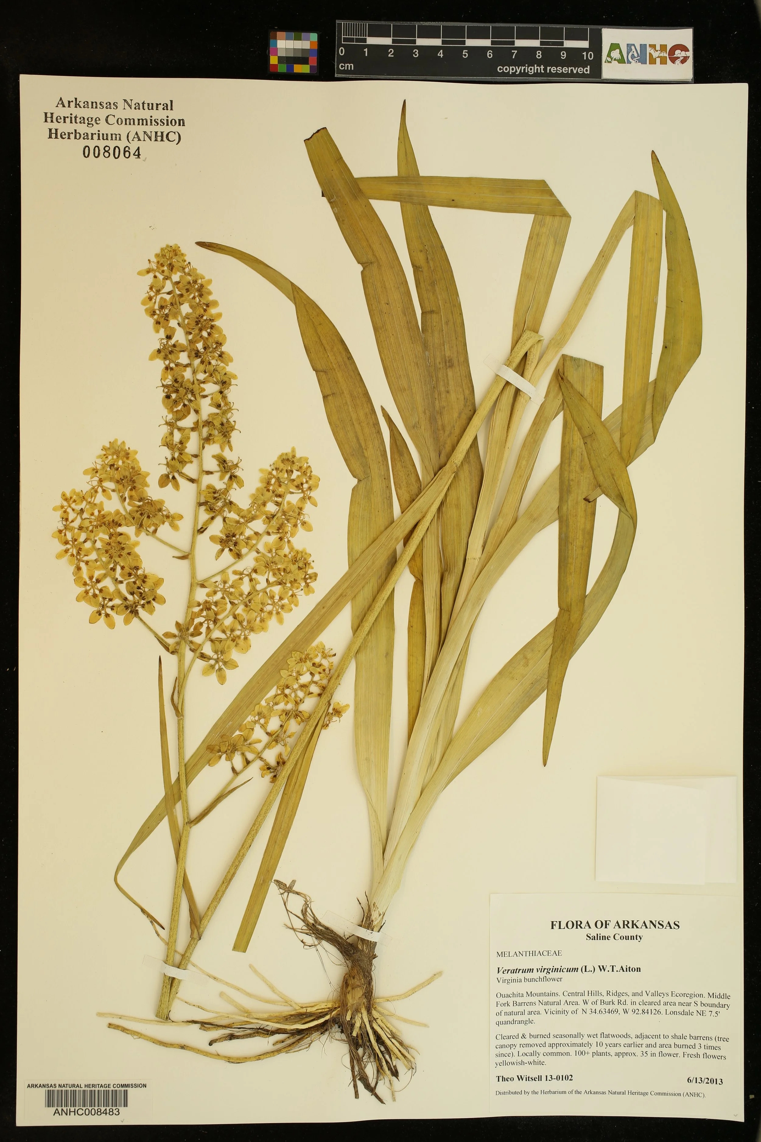
Herbarium specimens (pressed and dried scientific plant specimens) and other museum specimens are critical to documenting and studying biodiversity. SGI research staff regularly collect specimens of important plant occurrences to document them for the permanent scientific record. We also use them to understand where certain species occurred at certain times in the past. For instance, we can map occurrences of grassland-obligate species (species that are only found in grassland remnants) to understand where grasslands occurred historically and what species they supported.
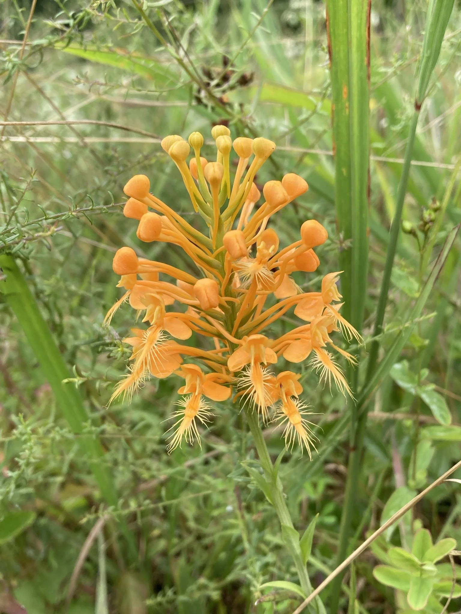
Spring Creek bladderpod (paysonia perforata)
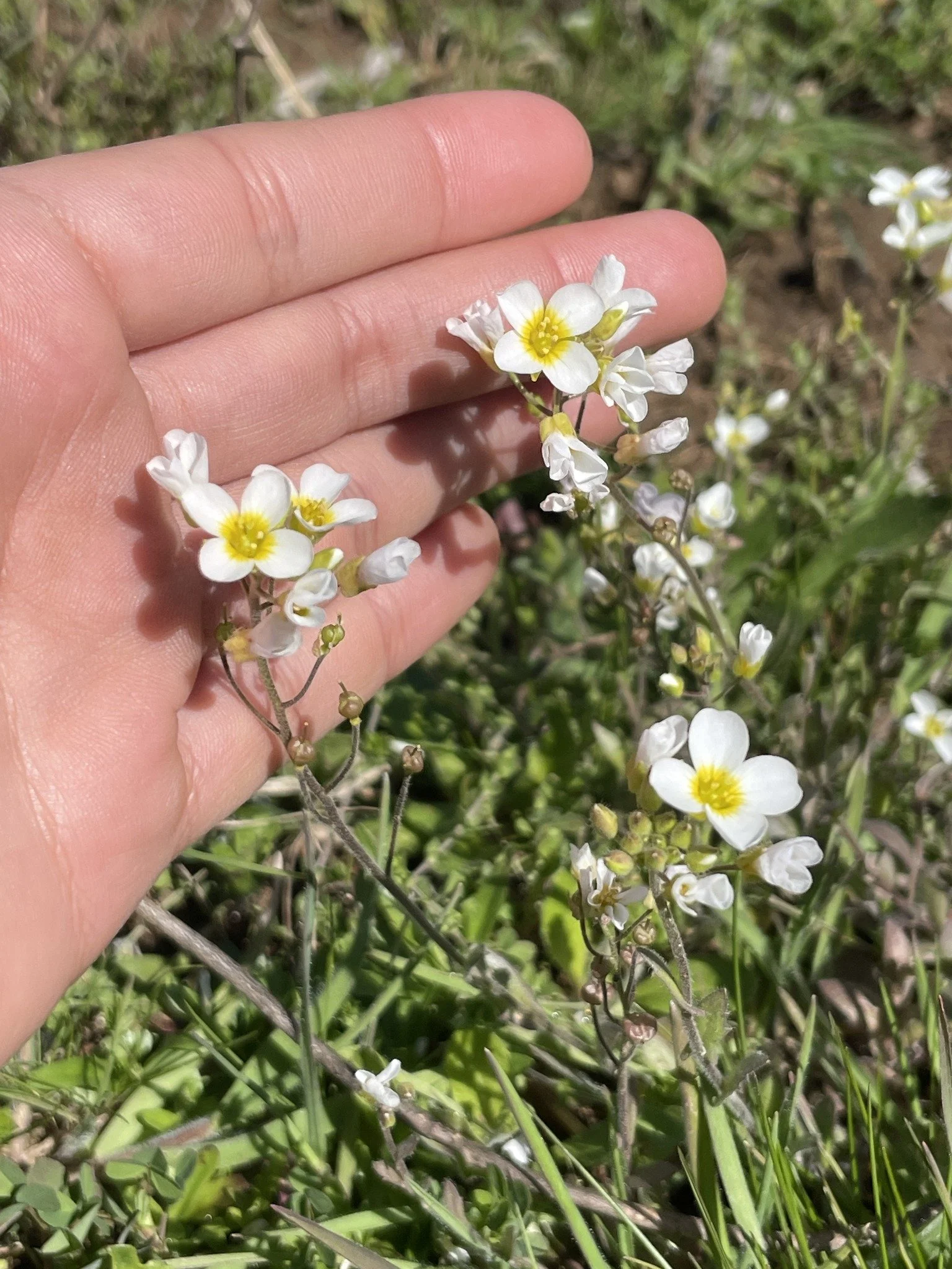
A close up of Spring Creek Bladderpod (Paysonia perforata) flowers. PC: Vero Tessier.
Spring Creek Bladderpod (Paysonia perforata) is a federally endangered plant found only in Wilson County, Tennessee. SGI staff found a previously known population on one of our grassland restoration sites and we’re working to better understand its ecology and management needs. An annual species, Spring Creek Bladderpod requires very specific conditions to germinate - the seeds have to be directly exposed to sunlight. Conventional management for the species involves plowing or disking a site to produce this effect, but we suspect that more natural disturbances produced this effect historically, so we’re taking an experimental and adaptive management approach with this population. Specifically, we’re assessing the effects of experimental prescribed fire and mechanical disturbances designed to mimic bison activity.
Sumter Farm & Stock Company Mapping & Inventory
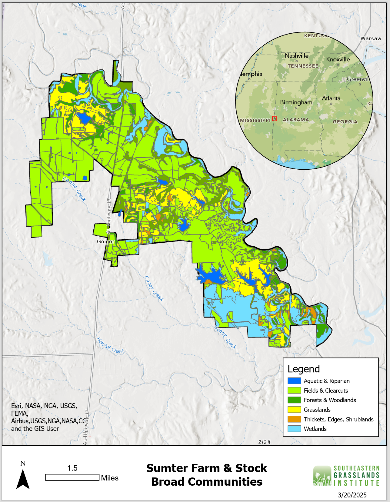
SGI is working with the Sumter Farm & Stock Company in the Black Belt Ecoregion of Alabama to map remnant grasslands, other ecosystems, and sites for future restoration work. All ecological communities are being mapped on the 11,000 acre property, which is unique in the ecoregion due to attentive land management, a nearly 100-year history of prescribed fire, and resulting abundance of remnant grasslands. A detailed inventory of the flora and fauna of the property is part of this project.
Vertical Grasslands

SGI's Central Appalachian Grasslands Coordinator Alaina Krakowiak documenting a population of Alabama lip fern (Myriopteris alabamensis) on a cliff face at Cumberland Gap National Historical Park. PC: Laura Boggess.
SGI’s Alaina Krakowiak was working with the National Park Service on monitoring rare plants of the Cumberland Gap National Historical Park, but was not finding the rare plants in their previously recorded sites at the base and tops of limestone cliff bands. Alaina hypothesized that the plants might be growing on the cliffs. Working with Dr. Laura Boggess, a cliff based ecologist, from Mars Hill University, Alaina repelled down the cliffs and found multiple sun-loving species growing on the cliff faces and ledges. An additional outcome of the vertical grassland work was taking tree ring core samples of very old cliff side eastern red cedars. Cliffs are under surveyed biodiversity hotspots, and Alaina’s work has helped to better understand plant communities in southeastern cliff ecosystems.


Past Projects & Partners
The Southeastern Grasslands Institute is grateful for the partnership of many agencies, donors, and organizations since our inception in 2016. Please see the list below of significant projects and partners that have advanced grassland restoration in our focal region.
-
To learn more about the Piedmont Prairie Partnership, please click here.
Below are a list of partners participating in the Piedmont Prairie Partnership:
-
Learn more about riverscour communities in our blog post #5 Interior Plateaus Limestone Riverscour Glade .
-
To learn more about our work with the Tennessee Department of Transportation (TDOT), please click here. To see our final report from our project with TDOT, click the link below: